Assessing Surface Water Dynamics of Wetlands in Reclaimed Mining Areas in the Athabasca Oil Sands Region, Alberta, Canada, with Time-Varying Sentinel-1 SAR and Sentinel-2 Multi-Spectral Imagery
Abstract
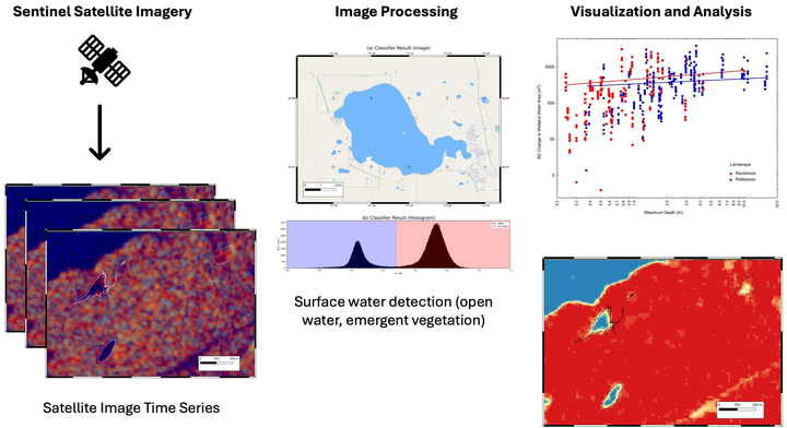
Wetlands provide critical ecological and socio-economic benefits, covering approximately 45% of the Athabasca Oil Sands Region in Alberta, Canada. However, open-pit oil sand mining has led to widespread wetland loss. While reclamation efforts are ongoing, the development of effective wetland monitoring methods remain essential. This paper presents a novel approach to tracking wetland dynamics in reclaimed and reference landscapes using Sentinel-1 SAR and Sentinel-2 multispectral imagery. We assess surface water extent and emergent vegetation, validating our satellite-based measurements against high-resolution UAV-derived wetland area data (R2=0.902). Our results reveal minor differences in intra-annual variability in wetland area between wetlands in reclaimed versus those in reference landscapes. Wetlands exhibit a positive log-linear relationship between maximum depth and variability in open-water area, a pattern that was consistent between landscape types. Intra- and interannual variability in spatial extent were both positively associated with wetland area. This paper introduces the first ground-truthed automated wetland monitoring approach for the region. These findings document the similarities in range of variation between wetlands developing in reclaimed and reference landscapes and provide a simple tool to support long-term monitoring to document the persistence of wetlands forming in reclaimed landscapes.